

1/3


Promoted
Lagos, Apapa
17 views
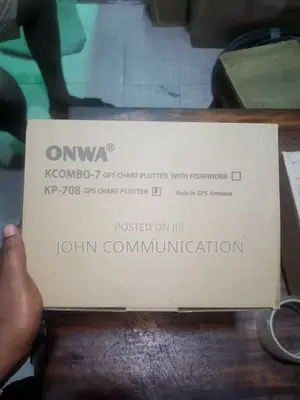
Onwa Combo-7gps Chart Plotter With Fishfinder
Security & Surveillance Accessories
Type
Brand New
Condition
Other
Brand
Waypoints/icons
12,000 user waypoints with name, symbol,
3 system waypoints: MOB,Start,cursor
10 proximity waypoints
Routes
30 routes waypoint up to 170 points each,
plus MOB and Track Navigation or Goto Track modes
Tracks
8,000 points automatic track log;
10 saved tracks (up to 8000 track points each)
lets you retrace your path in both directions
Alarms
XTE, Anchor drag, arrival, speed, voltage, proximity waypoint,
Timer and AIS (CPA and TCPA) alarm
Drawing
1000 Drawing Marks; 2000 Drawing Lines (40 points each);
1000 Drawing Place Name; 8 colors for Drawing
Pallete
Normal
Daylight exposed to sunlight
Night in dark environment
NOAA paperchart colors
Tides
Built-in Worldwide Tide Data
Position Format
Lat/Lon
Basemap
Worldwide
External Max
Compatible with K-Chart 2.0, K-Chart 3.0, C-Map Max and Navionics+
Safety tips
- Avoid paying in advance, even for delivery
- Meet with the seller at a safe public place
- Inspect the item and ensure it's exactly what you want
- Make sure that the packed item is the one you've inspected
- Only pay if you're satisfied